Everyone loves a new toy. Better still when the toy flies, processes and delivers usable imagery to clients in the same day.
Discussions about the benefits of Unmanned Aerial Vehicle (UAV) technology in agriculture and first response industries has been going on for a long time. In surveying, we’ve also seen over recent years how the use of this smart technology is improving processes and workflow, and benefiting our industry and clients with speed, efficiency, accuracy, and safety.
At BTW, our skilled and civil aviation authority (CAA) approved pilots can complete small and large-scale mapping work for complex sites and infrastructure, and large, difficult to transverse land parcels. With UAV tech, highly accurate spatial survey data is available with fast turnaround, giving clients the information, they need for informed decision making without lag time, and potentially improving investment, development, and project planning.
IT’S ALL ABOUT DETAIL
At BTW we’re combining the powers of surveying knowledge with high-tech UAV equipment and LiDAR technology to add value.
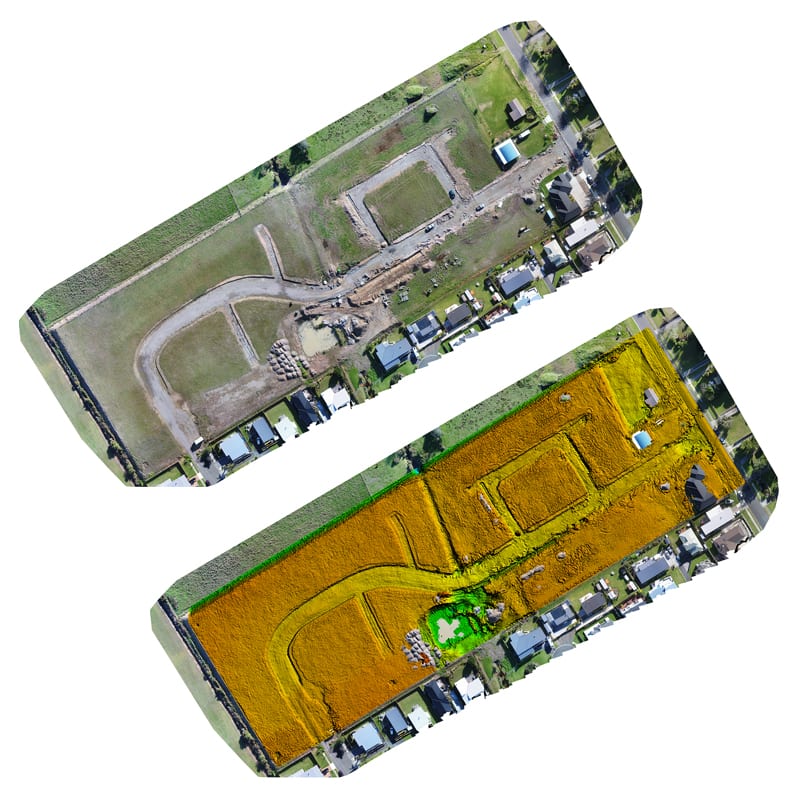
LiDAR creates precise, digital imagery representing ‘flat earth’ – of objects, buildings, and the ground with significantly more detail than common pictures. We orthorectify captured images, removing any effects of lens tilt or undulating terrain to maintain constant scale and show objects in their true positions.
We achieve survey grade accuracies from our platform and where necessary, we can extract point cloud data to create surface contours, digital terrain models and structures.
A recent example of this value add is on a current Waikato subdivision project. This is a land development opportunity with multiple stages. Covid-19 and the projected shift in how and where we will live, meant a mid-project rethink. Our Waikato surveying team were able to put new surveying options on the table for project stakeholders at low cost and with a quick turnaround.
If you’re considering subdividing, needing to apply for resource consent or a bush/land covenant, or wanting to answer questions and gauge project progress, the 3D mapping capabilities and volumetric calculations that LiDAR technology and UAV provides are an invaluable addition to BTW’s surveying practice.
Talk with BTW’s surveying team today.