3D Laser
Scanning
Saving time, money and materials is made possible with 3D laser scanning
3D laser scanning is an innovative technology which is revolutionising survey data capture techniques and is challenging traditional thinking.
What’s involved in 3D Laser Scanning?
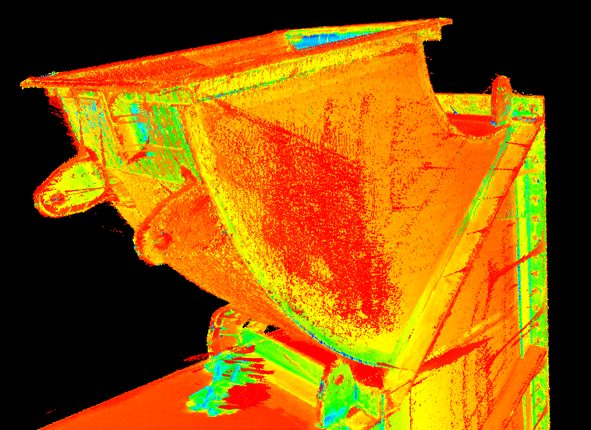
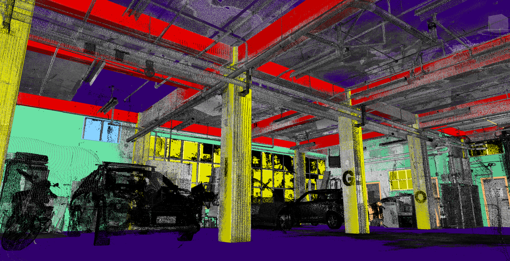
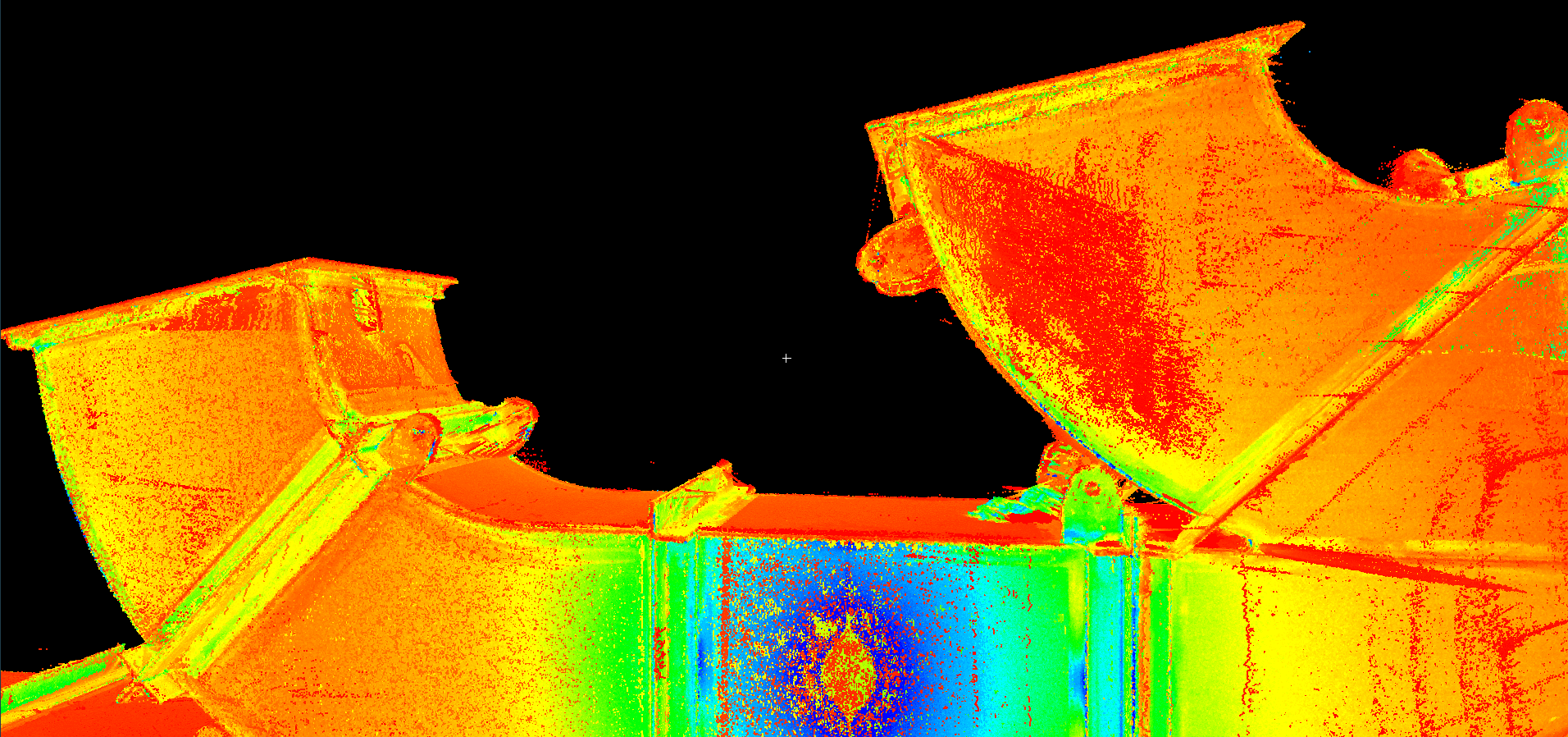
3D data capture complements BTW’s traditional surveying capabilities to provide clients with an unprecedented amount of accurate, high quality data in an efficient and user friendly manner. With point cloud data, rather than gathering single point data, the scanner captures the entire field of view, ensuring that every detail is recorded.
Our current 3D laser scanning capabilities are providing data capture for:
- Accurate as-built documentation of a facility for redesign and refurbishment projects, or for updating existing plant documentation in 3D
- As-Is Condition surveys for structures such as roads, railways, bridges, tunnels and buildings which require accurate and detailed datasets
- As-built and As-Is conditions for Mechanical/Electrical/Plumbing services and structures (BIM)
- Heritage buildings or historic site preservation and 3D visualization
- Determination of plumbness of structural elements such as beams, columns, walls or floors
- Monitoring of structures, coastal erosion or deformation
- Production of high resolution topographical maps which generate 2D and 3D CAD views enabling measurement of distances, areas, and volumes
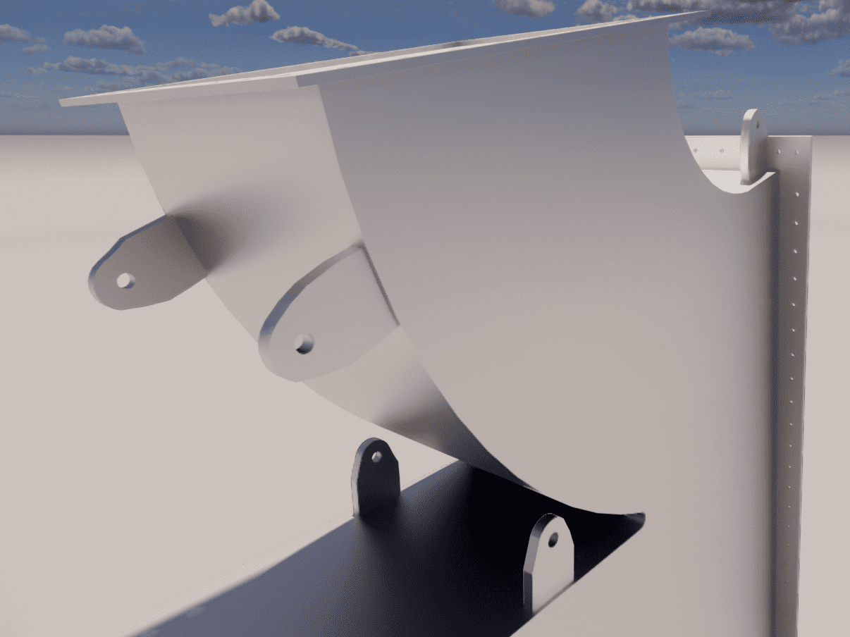
- Production of 3D modelled objects from as-built point cloud data
A streamlined process with improved outcomes
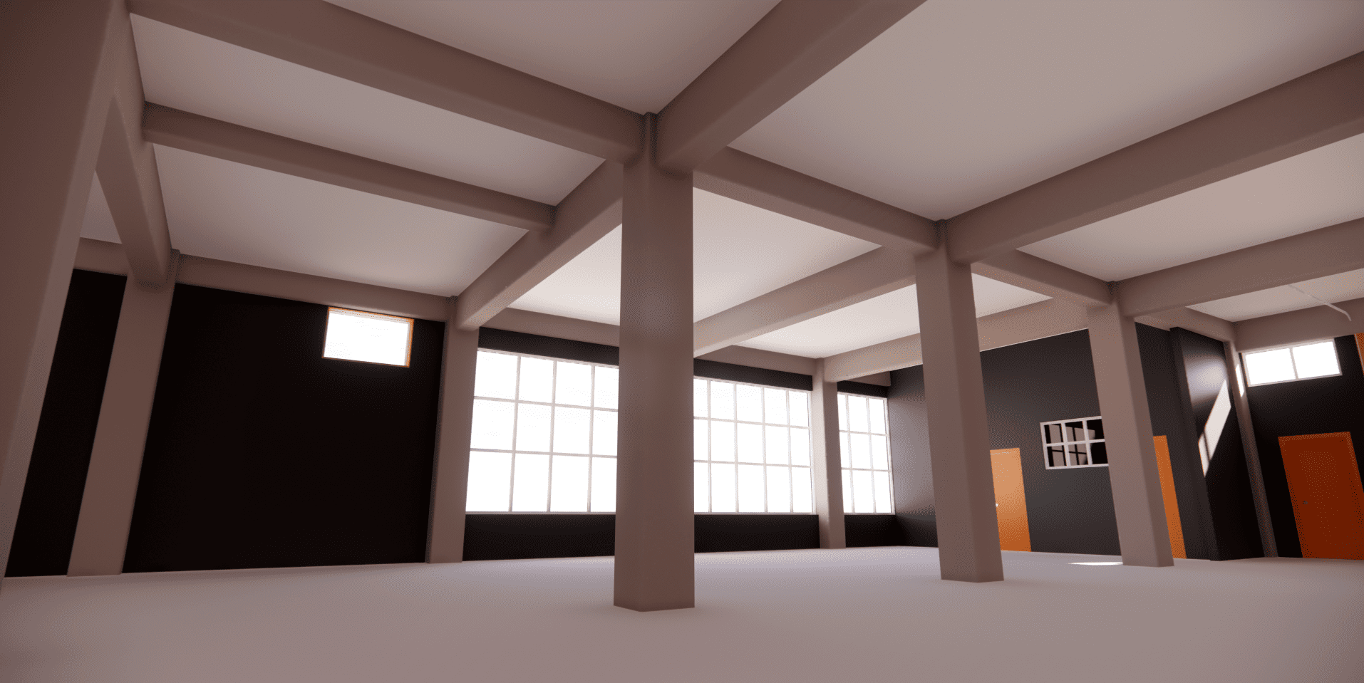
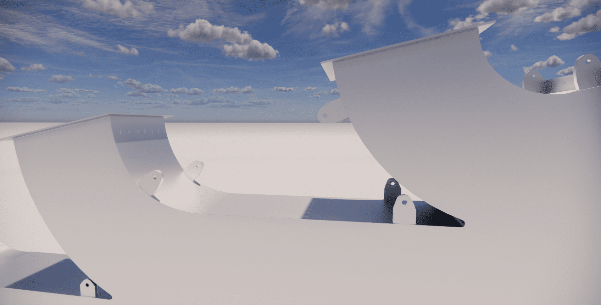
After using our precision 3D laser scanning instrumentation at your site, scan data is used to create 2D and 3D views and models in AutoCAD and Revit. These models can be submitted for design, consenting and compliance purposes or used by owners, stakeholders and consultant teams to inform their work, and better understand and manage asset lifecycles.
Our services
Learn how our expertise can produce successful outcomes for your project