Skip to content
n

  • Home
  • Services
    • Surveying
    • Environment
    • Planning & Resource Consents
    • Civil Engineering
    • Structural Engineering
    • Energy
    • Data & Project Management Solutions
    • 3D Laser Scanning
    • UAV Services
    • Geotechnical Services
    • Wai Eye – Water services
  • Projects
  • News
  • About
    • About BTW
    • Our Values & Culture
    • Our People
    • Careers & Vacancies
    • Health & Safety, Environment and Quality (HSEQ)
    • Community
    • Clients & Feedback
    • Memberships
  • Contact
Facebook-f Linkedin-in Instagram

Subdivision and
Land Development

Surveying

  • Surveying
  • Subdivision & Land Development
  • Mapping
  • Engineering surveying
  • UAV
  • 3D Laser Scanning
  • Building Information Modelling (BIM)
  • Virtual Reality (VR)
  • Mixed Reality (MR)
Menu
  • Surveying
  • Subdivision & Land Development
  • Mapping
  • Engineering surveying
  • UAV
  • 3D Laser Scanning
  • Building Information Modelling (BIM)
  • Virtual Reality (VR)
  • Mixed Reality (MR)
Get in touch

Guiding you through subdividing land or developing it for better use.

It’s our job to guide you through this process while providing the required technical services and knowledge along the way.

How does the subdivision process work?

Every subdivision project we work on starts with a conversation with the client to establish what their intentions for the land are.

From this first consultation we start guiding you regarding any rules around how many lots can be legally permitted on your land, what services need to be accounted for (e.g., electricity, gas, sewer) and which of our surveying services you may require.

As we navigate the regulatory system to satisfy local council requirements, we keep you in the loop with as much or as little contact as you would like.

Click here for BTW's full Subdivision Process
IMG-6113

What subdivision and land development services do we offer?

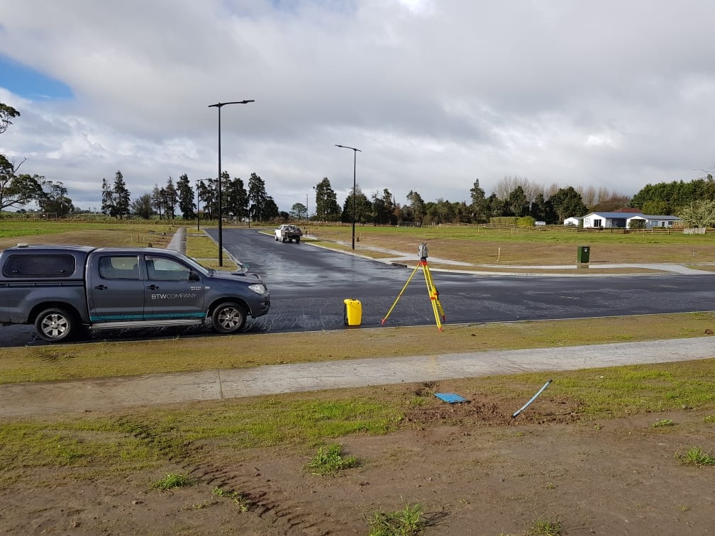
We use GPS and high tech instruments such as Robotic Total Station Theodolites to identify existing surveying marks, establish new ones and gather accurate data and imagery to help increase the value of your land. Our skilled team of subdivision and land development surveyors can assist you with the following:
  • Property boundary surveys
  • Small and large-scale subdivisions, both urban and rural
  • Project management and construction supervision for land development projects
  • Topographic surveys for architectural design
  • Cross-lease and Unit Title surveys
  • Easement surveys
  • Maori land plans
Make it happen today

Our services

Learn how our expertise can produce successful outcomes for your project

Surveying
Environment
Planning
Civil Engineering
Structural Engineering
UAV Services
3D Laser Scanning
Data & Project Management Solutions
Energy
Wai Eye - Water Services
See all projects
Get in touch
Careers & Vacancies

New Plymouth
179 Courtenay Street
New Plymouth 4310
New Zealand

06 759 5040​

Hamilton
517 Anglesea Street
Hamilton 3204
New Zealand

07 595 0020

Raglan
1 Wainui Road
Raglan 3225
New Zealand

07 595 0020

Taupō
12 Ashwood Avenue
Taupō 3330
New Zealand

0800 289 787
  • Contact
  • Privacy Policy
  • Site Map
  • Contact
  • Privacy Policy
  • Site Map
Facebook-f Linkedin-in Instagram
  • © BTW Company
  • 2023
  • Website by
Apex Digital